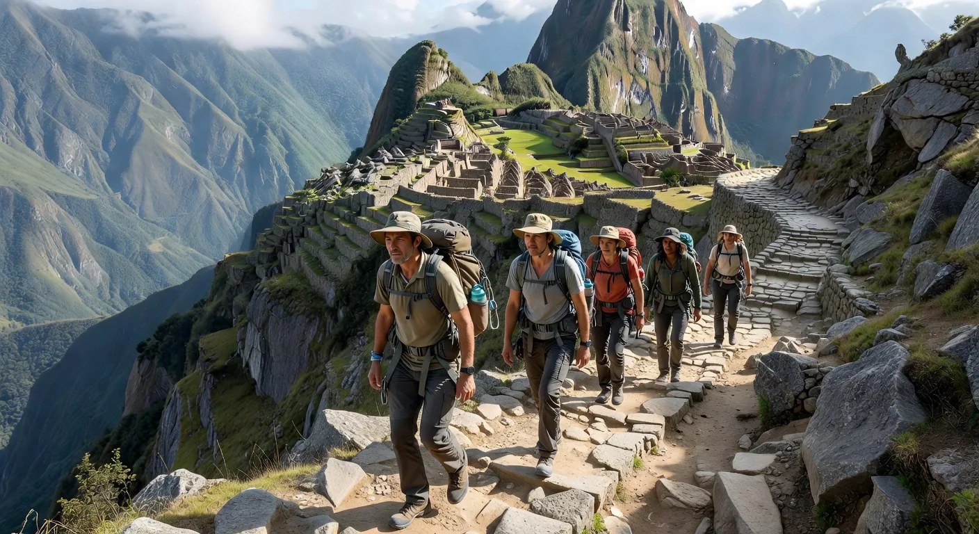
Most people who walk the Classic Inca Trail think of it as a hike. They focus on fitness, altitude acclimatisation, and the famous sunrise view of Machu Picchu through the Sun Gate. What they rarely consider is what the trail actually was: a sacred processional route, engineered over centuries to approach the mountain citadel through a carefully orchestrated sequence of landscapes, ruins, and ritual waypoints.
Walking it as an archaeologist — or even as an archaeologically informed traveller — transforms the experience entirely.
The Qhapaq Ñan: The World's Greatest Road Network
The Inca Trail to Machu Picchu is a tiny fragment of the Qhapaq Ñan, the Inca road network that ultimately covered more than 40,000 km — comparable in scale to the Roman road system but built without wheeled transport, horses, or iron tools. The name means "royal road" in Quechua, and that is exactly what it was: a system of state highways serving the administrative, military, and religious needs of Tawantinsuyu, the Inca Empire.
In 2014, UNESCO inscribed the Qhapaq Ñan as a World Heritage Site across six countries — Peru, Bolivia, Ecuador, Chile, Argentina, and Colombia — recognising it as one of humanity's greatest infrastructural achievements.
"The Inca road was not built for speed or commerce alone. It was built to make the landscape speak — to move people through a sequence of sacred encounters with mountain, sky, and stone."
A Processional Landscape
The Classic Trail begins at Km 82 on the Urubamba River (elevation 2,650m) and climbs through a series of increasingly dramatic landscapes to arrive at Machu Picchu (2,430m) after 43 km and four days. The route was clearly designed to build spiritual anticipation. The Inca sited rest stations (tambos) and ceremonial complexes at key points along the trail — Llactapata, Sayacmarca, Phuyupatamarca — each positioned to offer a carefully framed view of the mountains and valleys below.
The final approach through the Inti Punku (Sun Gate) at sunrise was almost certainly timed to align with astronomical events. The portal frames Machu Picchu perfectly only at certain times of year, bathing the approaching pilgrim in the first light of dawn.
Key Elevate Hub Core Along the Trail
Llactapata
Often overlooked by trekkers eager to push on, this complex 1.5 km from the trailhead appears to have functioned as a satellite of Machu Picchu, visible from the citadel's observatory and potentially related to its astronomical alignments. Recent LiDAR surveys have revealed previously unmapped structures in the surrounding jungle.
Sayacmarca
Perched on a clifftop spur at 3,580m, this beautifully preserved complex is one of the trail's highlights. Its semicircular tower, narrow stairways cut directly into the rock, and water channels demonstrate Inca engineering at its most sophisticated. The site's name — roughly "inaccessible place" — captures something of its drama.
Practical Notes for the Archaeological Traveller
Permits: The Inca Trail requires advance booking (often 6+ months ahead). Daily quota: 500 people including guides and porters.
Best Season: May–September (dry season). April and October offer quieter trails with occasional rain.
Altitude: Dead Woman's Pass reaches 4,215m. Acclimatise in Cusco for 2–3 days first.
Recommended reading: John Rowe's Inca Culture at the Time of the Spanish Conquest; Gary Urton's Signs of the Inka Khipu.
The Inca Trail is at its most powerful when understood as architecture for the imagination — a sequence of revelations designed by its builders to transform the traveller before they ever arrived at the citadel. Walk it slowly. Read the ruins. Look where the sightlines lead. The Inca left nothing to chance.
Dr. James Okafor is an archaeologist specialising in pre-Columbian civilisations of the Andes. He has led research expeditions across Peru, Bolivia, and northern Chile and teaches at Waseda University in Tokyo. He is a contributing editor at Elevate Hub Core.